
Ooboke and Koboke sections of the Yoshinogawa, Tokushima Prefecture
Class IV+
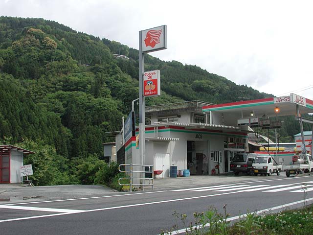
Logistics: Mapple 113 B2. The river runs along Highway 32 which runs north to south through the center of the island of Shikoku. The Ooboke and Koboke sections are two gorges that make up this run. For the full run, the put-in is behind a gas station across from the Toyonaga train station near the spot where Highway 439 meets Highway 32. The take-out is at the parking area on river left near the Awa-kawaguchi train station where Highway 319 meets Highway 32. In between the two gorges there is a flat section that tour boats run. You can take-out here if you want to only run the class III Oboke Gorge, or use this as a put-in if you want to run the class IV Koboke Gorge. Area Map
Scenery: It's too bad there's a road and a constant line of buildings along the canyon rim, but when you're down on the river you'll hardly notice. The bedrock scenery is impressive, but the run could hardly be called remote.
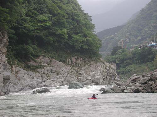
 Description: This bigwater run offers some of Japan's finest class IV whitewater. Big waves, big holes, and powerful hydraulics dominate the run and at higher flows a few of the drops in the Koboke section are class V. The run is mostly pool drop and most of the rapids can be easily scouted and portaged. Before committing to the run you can check out most of it from the road.
Flows are generally dependable for much of the year with consistent releases from a dam upstream. Spring flows are higher and provide the most action but beware of flood flows when the gorge is solid V+ bigwater (these can occur during heavy spring rains or late summer typhoons).
Access into the gorge is good with fisherman's trails that run down to the river at regular intervals on river left. The downside of course is conflicts that can develop with fishermen during the ayu season (June to September).
Down in the canyon.
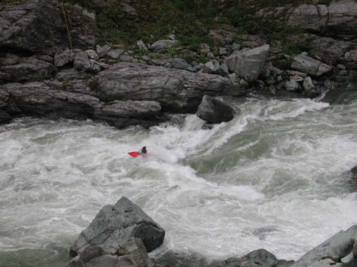
One of the bigger drops on the Koboke section. This thing is huge at river level.